Energy Corridor Maps and Geospatial Data
Maps and geospatial data of the West-wide Energy Corridors.
Section 368 Energy Corridor Mapping Tool
Interactive application for displaying and querying Section 368 Energy Corridor spatial data in your Web browser, with no large downloads. GIS data for the Section 368 Energy Corridor Mapping Tool has not been updated since March 2022.
Energy Corridor Geospatial Data Download
This download contains Geographic Information System (GIS) files of the Section 368 energy corridors that were designated by the Bureau of Land Management and the Forest Service in 2008 and 2009. These data are being used to support corridor siting, perform analyses, provide visualization products, and generate statistics. This download contains the GIS data in both shapefile and ESRI file geodatabase formats, with metadata.
| Section 368 Energy Corridor Geospatial Data (13.7 MB) |
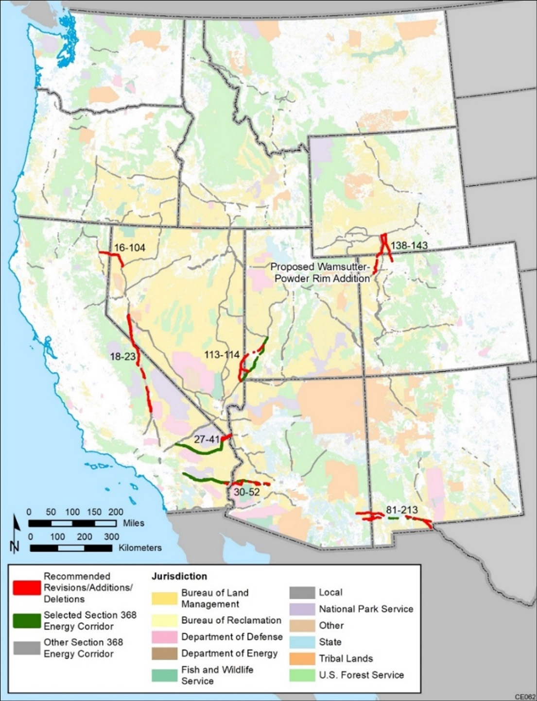
Energy Corridor Review – Potential Revisions, Deletions, and Additions
This download contains GIS data associated with conceptual revisions, deletions, and additions that were developed through the energy corridor regional reviews.
| Potential Section 368 Revisions Deletions Additions Geospatial Data (1.4 MB) |
Maps of Section 368 Energy Corridors to Be Evaluated in Energy Corridor Revisions RMPA/EIS
 |
Corridor 16-104 (74.2 MB) |
|
Corridor 113-114 (62.1 MB) |
|
Corridor 81-213 (71.2 MB) |
|
Corridor 18-23 (83.2 MB) |
|
Corridor 18-23 (whole corridor) (83.6 MB) |
|
Corridor 27-41 (78.9 MB) |
|
Corridor 30-52 (75.6 MB) |
|
Corridor 138-143 (61.4 MB) |
Energy Corridor Revisions RMPA/EIS
Please Note: This page provides updated geospatial data for the Section 368 energy corridors. For maps/data from the 2009 West-wide Energy Corridor PEIS, see the West-wide Energy Corridor Final PEIS Maps page.